
1853 map of Massachusetts, Connecticut, Rhode Island, by Daniel Burgess - $6 - (Cambridge, WI)
Back to Search Results
Posted 1 month ago
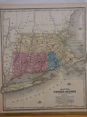
This is a map of Massachusetts, Connecticut, and Rhode Island, published in 1853 by Daniel Burgess. It may be from a geography book of the time. It is labeled as Map No. 2 United States. The map measures about 9.5 x 11.5 inches. On the back is "Lesson" on the New England states., and is covered with paper and plastic (the plastic is taped on to the paper, not the map, so could be taken off if desired--this is the way in which I received it). Nice condition with some page fading (please see photos for condition).
ADVERTISEMENT
From ebay.com - 1 month ago