
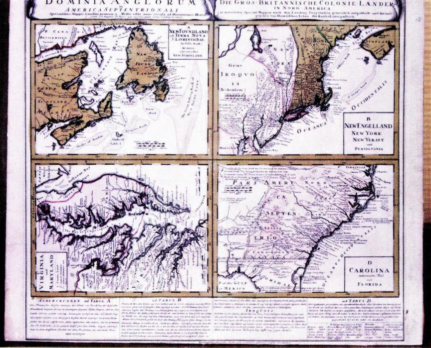
Antique Map c.1750 Newfoundland & East Coast Colonies of North America - $515 - (Grass Valley, CA)
Take a walk through history with an 18th century map of the east coast of North America and Newfoundland.Journey with pioneers and imagine viewing new lands, meeting the indigenous people and start a new life. The time frame and the printing in Dutch indicates this is most likely a G.F. Lotter map. See photo of this 2 page well detailed atlas map circa 1750 mounted on an acid free board. The colored map is 24 inches wide by 20.5 inches high. It is composedin quad style with photos of each quad included in this listing. The map pages are joined fairly well and the printing on rag paper is very clear There is information related to the Iroquois nation and skirmisheswith the colonists dated 1712 &1716. At the right bottom of the main mapis a paragraph about the Iroquois in the dutch language . Much translationon the map from Dutch to English. There doesn't seem to be a legend or press mark. The very bottom ofthe map is slightly cut off, but there is a sentence in Latin. The upper portionthe main map may have the above information. The map is in need of cleaning. There isn't any foxing.There are smudges in the lower and upper margins from handling. There are almost invisible wrinkles from mounting. Overall, it is in good condition for 262 year old handled paper. We strive to be as accurate as possible in our descriptions. Payment is by Paypal only.Buy it now requires immediate payment.We ship as quickly as possible.Shipping to US only. No International shipping. Please contact us if there are questions. Thanks for looking.


ADVERTISEMENT
From ebay.com - 1 month ago