
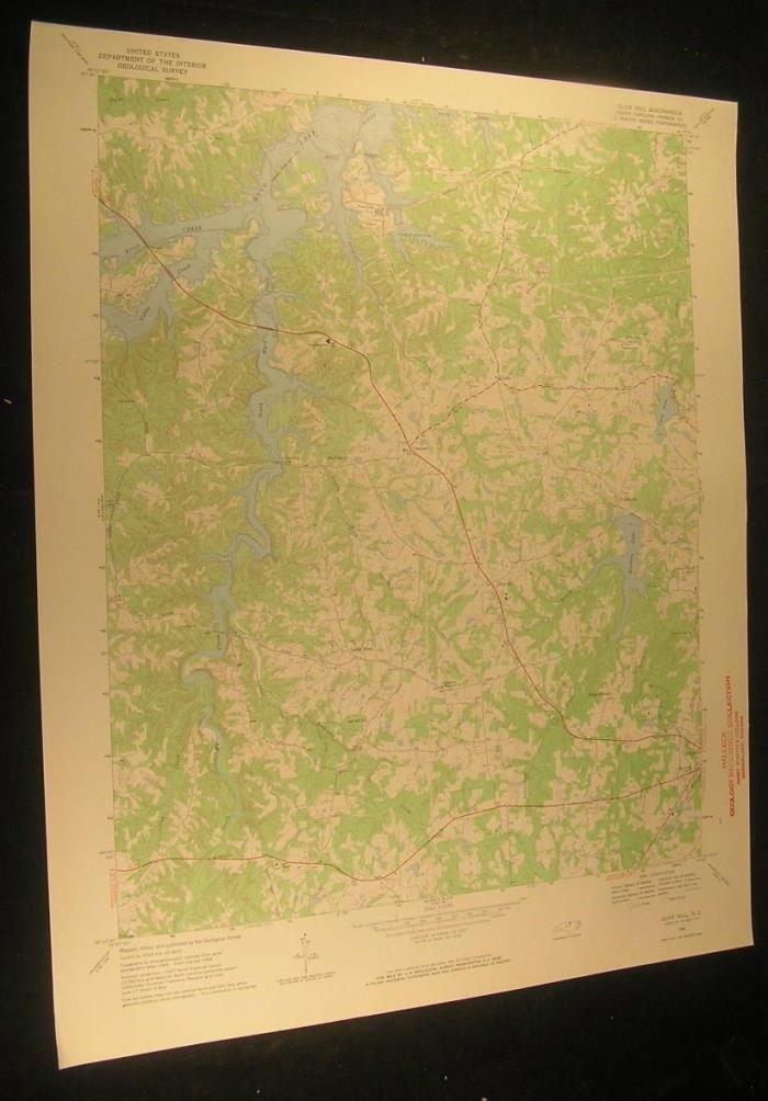
Olive Hill North Carolina Hyco Lake 1971 vintage USGS original Topo chart map - $35 - (Dover, NH)
Olive Hill Quadrangle (United States, Person County, North Carolina, Longs Store, Hicks Village, Roxboro, Hyco Lake, Chub Lake, Power Plant, Industrial Waste Pond, Concord, Five Forks, Norfolk & Western Railroad, Skimmer Wall) Issued 1971, Washington D.C., by the U.S. Geological Survey [USGS] An attractive vintage color lithographed topographical survey chart/ map. This is not a modern copy, it is old from date listed. Printed in the 20th century, on paper which has slightly gently age toned as always, but which remains sound, mostly very clean & well preserved. A detailed map worthy of display which is not often seen and no longer printed by the Government. In Good+ to VG or better condition; could be short minor edge splits now closed on back with archival tape, some minor wrinkling, normal uniform minor age toning to sheet as typical, an institutional rubber stamp mark in the blank side margin as is visible in photo, and trivial scattered staining, spotting or foxing. Overall the printed image remains clean, well preserved and attractive. Great chart for display with a profusion of detail. Sheet measures c. 27 1/8" H x 22 1/8" W. Printed area measures c. 22 7/8" H x 18 1/2" W [104237]


ADVERTISEMENT
From ebay.com - 1 month ago