
1800s antique HOPKINS ATLAS hc w/10 MAPS of PENNSYLVANIA and COUNTIES partial - $295 - (Avondale, PA)
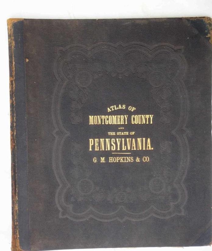
. .1800s antique HOPKINS ATLAS hc w/10 MAPS of PENNSYLVANIA and COUNTIES partialClick HERE to view or search ANTIQUE.COTTAGE listings. This listing is for the hardcover book with tipped in maps shown. Measures approx 15.75" x 13.75". The cover is textured brown cloth over board with black leather spine. Overall good for age with some scuffs and wear as shown. Missing title page and the first 73 pages with maps. The maps are mostly good with mostly edge wear. The last map shows the most wear, but still good foldout maps. The pages are still mostly white with only light age spotting or soiling. You get the following maps: 1. Outline map of the state of Pennsylvania (2 page spread) 2. Map that shows lake erie and railroad tracks (pg 78-79) 3. Map with railroad tracks (pg 82-83) 4. Foldout map (pg 87) 5. 2pg map (pg 90-91) 6. Foldout map (pg 93) 7. 2pg map (pg 98-99) 8. 2pg map (pg 102-103) 9. 2pg map (pg 106-107) 10. large foldout map (pg 111) CONDITION: see description AND scroll down for photos- Pennsylvania residents to pay 6% sales tax.- International buyers are responsible to pay VAT or other Taxes to their countries as required. LOC: BOOKSHELF11-TMLOC2: BOOKSHELF11-TM Powered by SixBit's eCommerce Solution


ADVERTISEMENT
From ebay.com - 1 month ago