
GARMIN BLUECHART FLORIDA to BAHAMAS MUS503L 010-C0057-00 MARINE CHART MUS009R - $95 - (Arkport, NY)
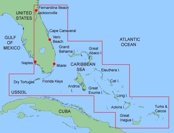
THE "L" IN THE MUS504L DESIGNATION MEANS LARGE. THIS CARD COVERS A LARGER AREA THAN THE COMPANION MUS009R MUS503L Covers: . FEATURING DATA FROM EXPLORER CHARTS FOR THE BAHAMAS! Detailed coverage from Fernandina Beach through the Florida Keys north to Marco Island with coverage of Lake Okeechobee. Coverage of the Bahamas includes the Grand Bimini, Grand Bahama, Turks and Caicos the Great Inagua, Rum Cay, Cat Island, and Great Exuma Chart-specific information, including chart name and number, scale, revision date, latest Notice to Mariners date Object-oriented cartography Faithful representation of published official paper charts Shaded depth contours Intertidal zones Spot soundings Navaids with view range and coverage Port plans Tides, wrecks, restricted areas and anchorages Trip and waypoint management functionsCOMPATIBLE GARMIN GPS MODELS GPSMAP 172, 172C, 176, 176C, 178, 178C, 182, 182C, 188, 188C, 192C, 196, 198C, 2006, 2006C, 2010, 2010C, 232, 238, 276C, 292, 296, 298, 3005C, 3006C, 3010C, 376C, 378, 396, 478 and STREETPILOT III THIS IS A PROPRIETARY GARMIN DATA CARD THE SIZE & SHAPE AS SHOWN BELOW. NOT SD CARD, NOT MICRO SD CARD. On Jul-07-08 at 04:13:29 PDT, seller added the following information: Japanese Buyer Assistant
ADVERTISEMENT
From ebay.com - 1 month ago