
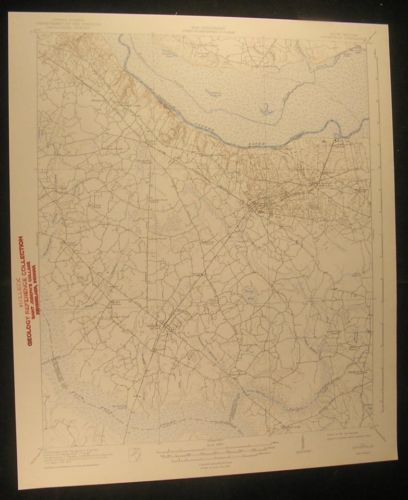
Eutawville S. Carolina Target School 1942 vintage USGS original Topo chart map - $32 - (Dover, NH)
Eutawville Quadrangle (United States, South Carolina, Holly Hill, Four Hole Swamp, Santee River, Ferguson, Vance, Milligans, Lumber Railroad, Eutaw Spring Battle Monument, Target School) Issued 1942, Washington D.C., by the U.S. Geological Survey [USGS] An attractive vintage color lithographed topographical survey chart/ map. This is not a modern copy, it is old from date listed. Printed in the 20th century, on paper which has slightly gently age toned as always, but which remains sound, mostly very clean & well preserved. A detailed map worthy of display which is not often seen and no longer printed by the Government. In Good+ to VG or better condition; could be short minor edge splits now closed on back with archival tape, some minor wrinkling, normal uniform minor age toning to sheet as typical, an institutional rubber stamp mark in the blank side margin as is visible in photo, and trivial scattered staining, spotting or foxing. Overall the printed image remains clean, well preserved and attractive. Great chart for display with a profusion of detail. A picture is worth a thousand words. The zoomable image is a major part of the item description. Please examine closely, as what you see is what we will send you. [note: we grade very conservatively and always seek to disclose any noteworthy flaws]. Text on verso as issued. A fascinating and stunningly detailed vintage map which any collector, dealer, institution or person of artistic taste would be happy to own and display. Sheet measures c. 20" H x 17" W. Printed area measures c. 17 1/2" H x 14 5/8" W [103987]


ADVERTISEMENT
From ebay.com - 1 month ago