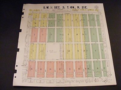
1931 West Allis / Milwaukee Wisconsin WI Antique Plat Map Jefferson Elementary - $25 - (Watertown, WI)
Back to Search Results
Posted 1 month ago
Great original, antique 1931 plat map on Linen / oil cloth. West Allis Wisconsin from Burnham Ave south to Lincoln Ave, and from what is now 67th St. (labeled 59th on map) west to 76th St. (labeled 68th St on map). Many streets have been renamed since map was made, map shows where Jefferson Elementary currently is. Map measures 16 1/2" X 16 1/2".Map is on linen / oil cloth, NOT ON PAPER. Published by the Milwaukee Real Estate Board. No rips, stains, holes, etc. Very nice, original vintage map, not a reproduction. Vibrant vintage colors. Rarer map. We have many more Milwaukee plats, contact us if looking for another area. #476

ADVERTISEMENT
From ebay.com - 1 month ago

