
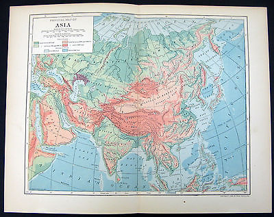
1906 Physical Map Asia Showing Elevations Ocean Depths Statute Miles Kilometers - $12 - (Great Bend, KS)
This is an original antique physical map of Asia showing land elevations and ocean depths--the shadings make for a very attractive map. This map is Copyright 1906 by Dodd, Mead & Co.--it is from an encyclopedia published in 1909 and is guaranteed authentic from that time. The engravers were L. L. Poates & Co. of New York. This is a tipped in map with center fold as issued. The map size is 12 1/2" x 9 7/8". The printed area is 10 3/8" x 8 1/2" and is in very good plus condition. The margins have light age toning and a very small stain. The second picture is a little brighter than the actual map but showing it for better detail. Please zoom and enlarge the pictures for best detail. This map will be placed in a an archival protective sleeve and shipped in a sturdy cardboard reinforced envelope. Payment is due within three days after purchase and I ship the next business day after receiving payment. Additional paper items ship postage free--please wait for my combined invoice to pay. Thanks for looking.

ADVERTISEMENT
From ebay.com - 1 month ago