
GARMIN BLUECHART SOUTEAST CARIBBEAN MUS030R CARD MARINE CHART 010-C0044-00 - $110 - (Arkport, NY)
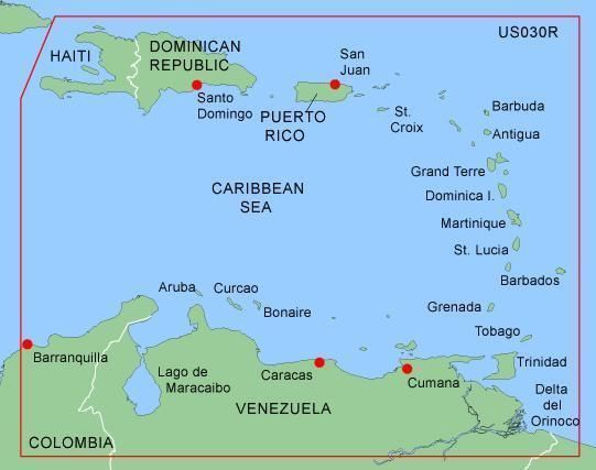
Garmin Bluechart Data Card Mus030R SOUTEAST CARIBBEAN MUS030R Covers: Caribbean from Haiti to Trinidad & Tobago, including Puerto Rico and all of the Lesser Antilles. Also includes the Colombian and Venezuelan coasts from Barranquilla, Colombia to the mouth of the Orinoco River, including Lake Maracaibo and the Gulf of Paria MapSource BlueChart serves up the best offshore cartography around and works in seamless integration with a wide range of Garmin products. Features Include: Chart-specific information, including chart name and number, scale, revision date, latest Notice to Mariners date Object-oriented cartography Faithful representation of published official paper charts Shaded depth contours Intertidal zones Spot soundings Navaids with view range and coverage Port plans Tides, wrecks, restricted areas and anchorages Trip and waypoint management functionsCOMPATIBLE GARMIN GPS MODELS GPSMAP 172, 172C, 176, 176C, 178, 178C, 182, 182C, 188, 188C, 192C, 196, 198C, 2006, 2006C, 2010, 2010C, 232, 238, 276C, 292, 296, 298, 3005C, 3006C, 3010C, 376C, 378, 396, 478 and STREETPILOT III THIS IS A PROPRIETARY GARMIN DATA CARD THE SIZE & SHAPE AS SHOWN BELOW. NOT SD CARD, NOT MICRO SD CARD. On Jul-07-08 at 04:13:29 PDT, seller added the following information: Japanese Buyer Assistant
ADVERTISEMENT
From ebay.com - 1 month ago