
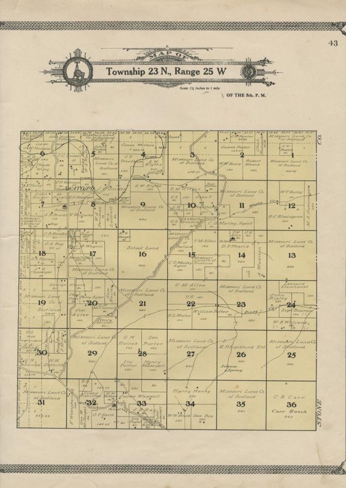
Mineral Township Plat Map 2 (Barry County, Missouri) 1909 Land Owners, Schools + - $36 - (Iowa City, IA)
I have many similar items in my ebay store. Please click to view. Detailed Plat Map; Authentic 1909 Part of Mineral Township; Barry County, Missouri (This is a genuine map from 1909 -- NOT a reproduction) Authentic plat map removed from the Standard Atlas of Barry County; published by George A. Ogle & Co.; in 1909. (see scan of the atlas cover at the bottom of this listing) In this atlas, the Barry County townships were identified only by number, in this case: Township 23 N., Range 25 W. This area is in today's Mineral Township. Cato Post Office is shown on this map. Schools, cemeteries, churches and roads are located. The owner of each parcel is identified. The Missouri Land Company of Scotland held thousands of acres of Barry County land at the time and are shown as owners of numerous parcels. This map shows conditions as of 1909. Condition: Very Good - as shown. The page size is about 15" x 17.5" and the printed border seen on the top and bottom in the scan also runs on the left and right edges. The map is a bit too large for my tabloid sized scanner. Size within the printed border is 13.25" x 15.75". Blank on the reverse
ADVERTISEMENT
From ebay.com - 1 month ago