
1764 Jacques Bellin Carte Reduite de la Partie la plus Meridionale de L'Amerique - $80 - (Point Roberts, WA)
Back to Search Results
Posted 1 month ago
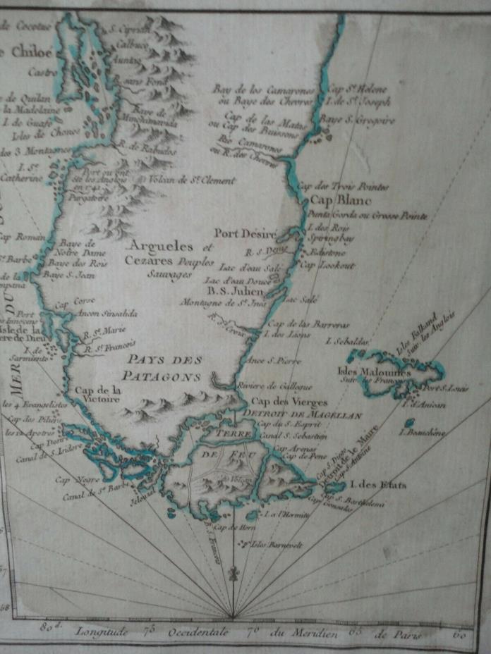
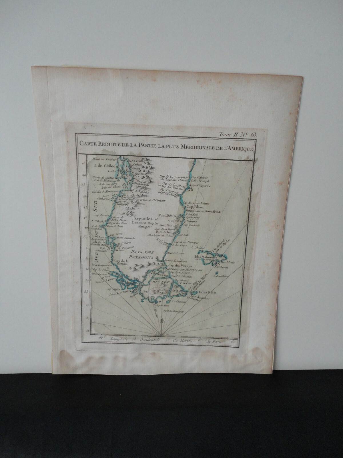
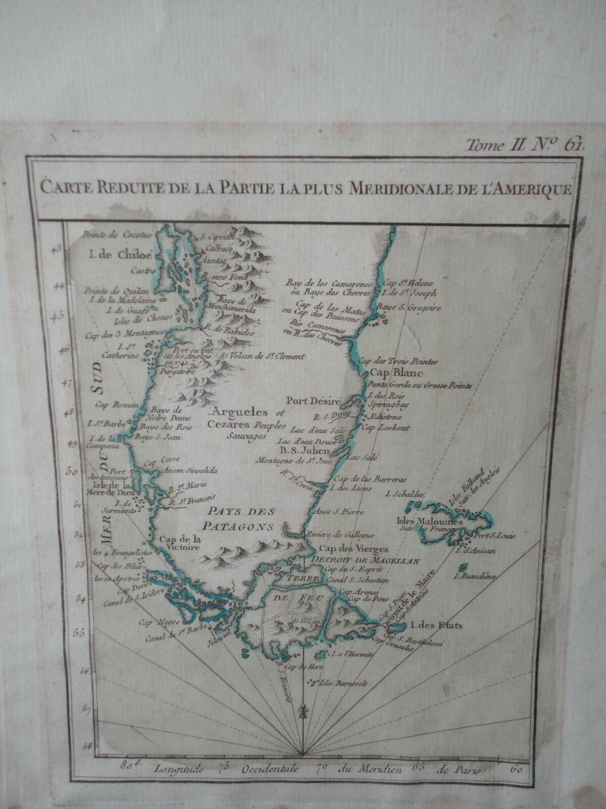
1764 Jacques Bellin Carte Reduite de la Partie la plus Meridionale de L'Amerique condition- margins show water stain (lower margin mostly). approx map view 9"x7". Finely detailed map of the Straits of Magellan, Patagonia and the southern part of the Andes, etc, published by Nicolas Bellin. Only a portion of the Malvinas (Falkland Islands) is charted in this map. The map was produced by Jacques-Nicolas Bellin (1703-1772), France's pre-eminent maritime cartographer and the Premier Ingénieur of the Depot de la Marine (the French Hydrographical Office), as well as the Official Hydrographer of the King Louis XV.
ADVERTISEMENT
From ebay.com - 1 month ago