
Manistee Michigan 1983 Original Vintage USGS Topo Map - $35 - (Dover, NH)
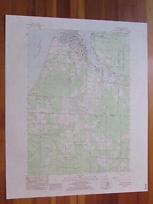
Manistee Quadrangle Michigan 7.5 Minute Series Published by the United States Geological Survey Year Published: 1983 Edition Year: 1982 Places: Manistee, Eastlake, Filer City, Oak Hill, Stronach Water Bodies: Canfield Lake, King Lake, Lake Michigan, Little Manistee River, Manistee Lake, Manistee River, Shingle Mill Lake, Tainer Lake Other Features: Huron-Manistee National Forest Map may have red institutional rubber stamp and/or writing in the margin - please see the photograph. The map in the photo is the actual map you will receive. Map sheet measures approximately 27 X 22 inches. All maps we sell are original USGS topographic maps, printed in the year stated in the title. We do not sell reproductions. Maps are shipped rolled up in a sturdy tube. [4912]
ADVERTISEMENT
From ebay.com - 1 month ago