
ORIGINAL CIVIL WAR ATLAS MAP:SOUTHEAST VIRGINIA,FORT MONROE,BATTLEFIELDS,RRs,rds - $23 - (Reading, PA)
Back to Search Results
Posted 1 month ago
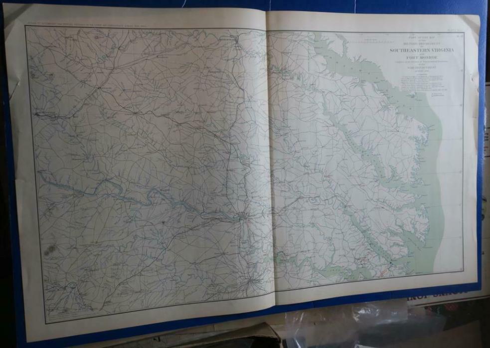
One complete, uncut, ORIGINAL Civil War Atlas map sheet...18" by 29"...from the 1890's U.S. Government limited issue ATLAS TO ACCOMPANY THE OFFICIAL RECORDS OF THE UNION AND CONFEDERATE ARMIES. Plate number 16, in VG original condition is a large, highly detailed map containing parts of SE VA and Ft. Monroe during The Civil War. THE OFFICIAL ATLAS, was contributed to by the military, civil engineers and cartographers, and was intended as a reference to and from The OFFICIAL RECORDS OF THE CIVIL WAR. Average 1" margins on all 4 sides. A clean and complete double-page ORIGINAL map sheet from the Atlas.


ADVERTISEMENT
From ebay.com - 1 month ago