
Blue Island Illinois 1983 Original Vintage USGS Topo Map - $40 - (Dover, NH)
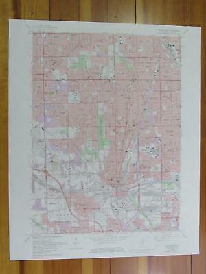
Blue Island Quadrangle Illinois- 7.5 Minute Series Published by the United States Geological Survey Year Published: 1983 Edition Year: 1963 Places: Blue Island, Hometown, Calumet Park, Alsip, Dixmoor, Evergreen Park, Posen, Riverdale, Robbins, Merrionette Park, Midlothian, Hazel Green Water Bodies: Calumet River, Calumet Sag Channel, East Arm Little Calumet River, Little Calumet River Map may have red institutional rubber stamp and/or writing in the margin - please see the photograph. The map in the photo is the actual map you will receive. Map sheet measures approximately 22 X 27 inches. All maps we sell are original USGS topographic maps, printed in the year stated in the title. We do not sell reproductions. Maps are shipped rolled up in a sturdy tube. [11306]
ADVERTISEMENT
From ebay.com - 1 month ago