
Vintage 1948 USGS Topo Map Castle Rock Colo. Original Includes Elizabeth Sedalia - $25 - (Denver, CO)
Back to Search Results
Posted 1 month ago
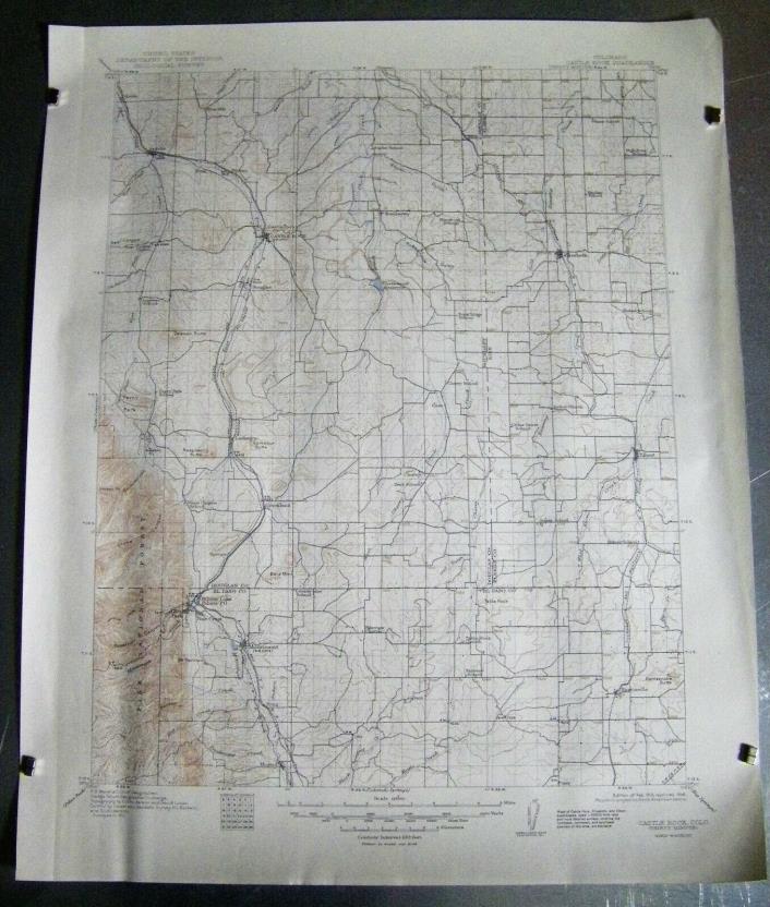
USGS Topographical Map of Castle Rock, Colorado Quadrangle (Thirty Minute) Edition of February 1913 reprinted 1948. 17 inches by 21 inches. Points of interest included:Towns of Castle Rock, Elizabeth, Sedalia, Greenland, Palmer Lake, Pine Crest, Monument, Eatonville. Also, Perry Park and Glen Park. Beautiful decorative browns and blues. Ready for framing. Please let me know if you would like more pictures or have any questions. I will ship it in a sturdy mailing tube.


ADVERTISEMENT
From ebay.com - 1 month ago