
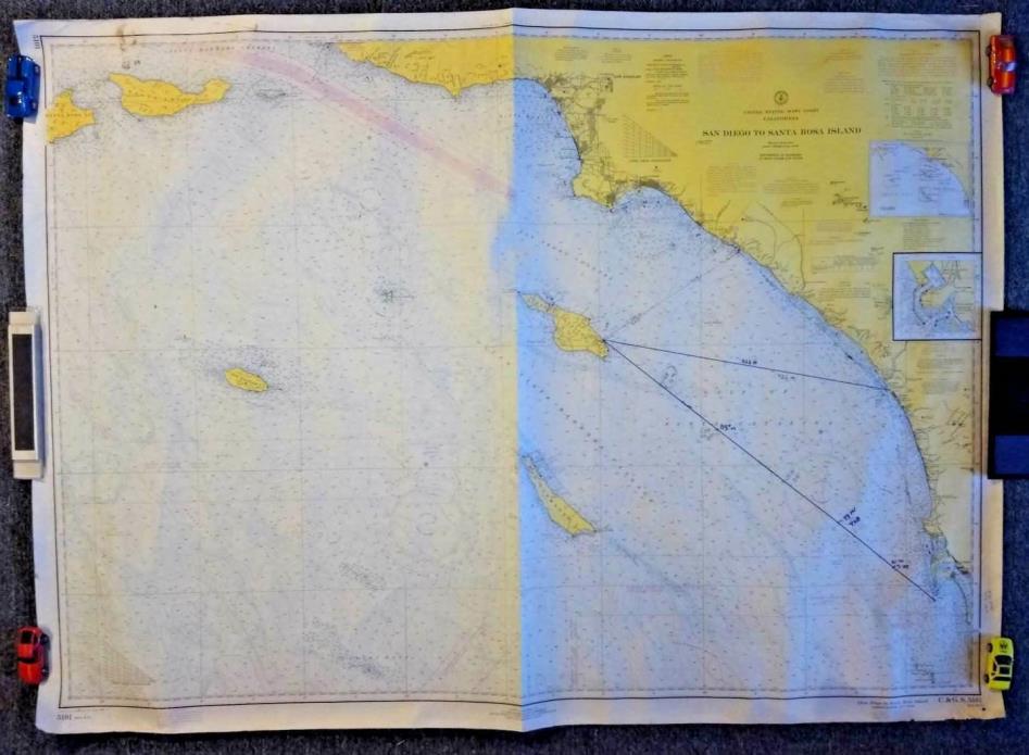
1970 "San Diego to Santa Rosa Island" California Nautical C&GS Map / Chart 36x50 - $40 - (San Diego, CA)
Back to Search Results
Posted 1 month ago
Available is a vintage 1970 "San Diego to Santa Rosa Island" California Nautical Map / Chart 5101 measuring approximately 36" x 50". Published at Washington D.C. U.S. Department of Commerce, Environmental Science Services Administration, Coast and Geodetic Survey (C&GS) 5101. United States - West Coast - California - San Diego To Santa Rosa Island - . Mercator Projection. Soundings in Fathoms. CONDITION: Very Good (VG) = there is some writing on the map, wear with a little loss along the bottom edge. Your map will be rolled, packed securely in a tube and shipped promptly to ensure it arrives to you in the condition described as soon as possible. Thanks for shopping. I appreciate the opportunity to earn your business.


ADVERTISEMENT
From ebay.com - 1 month ago