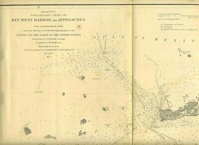
Key West Harbor & Approaches Florida Coast Survey Map 1851 Preliminary Chart - $250 - (Dallas, TX)
Key West Harbor & Approaches Florida Coast Survey Map 1851 Preliminary Chart This is Sketch F No 5. Preliminary Chart of Key West Harbor and Approaches from the Sketches Accompanying the Annual Report of the Superintendent of the United States Coast Survey 1851. The map measures about 17" x 18 1/2". There is on formerly bound edge. A very nice original historical drawing, that would look great framed. In very fine condition. With Detailed Sailing Directions, Notes, Tides,Sections of the Reefs, Elevation of the Coral Heads and more. Due to the size limitations of my scanner, the entire item may not show in some of the scans. Our Policies: For MULTIPLE PURCHASES A single payment for all items would be appreciated. WE SHIP WORLD WIDE Please contact us for shipping costs outside the United States, if they are not included in the listing. Delivery time of some International Packages may be 4 to 10 weeks or more International Buyers – Please Note: Import duties, taxes, and charges are not included in the item price or shipping cost. These charges are the buyer's responsibility.Please check with your country's customs office to determine what these additional costs will be prior to bidding or buying. STATE TAX Shipments in the State of TEXAS will be charged 8.25% sales tax . You may be interested in our other eBay listings. Powered by SixBit's eCommerce Solution

ADVERTISEMENT
From ebay.com - 1 month ago

