
1863 RICHMOND VA PENINSULAR CIVIL CAMPAIGN WAR MAP Johnson Geography Atlas - $35 - (Pelham, AL)
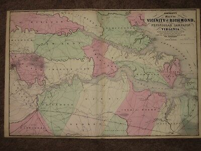
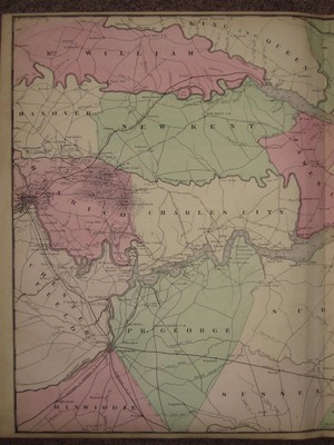
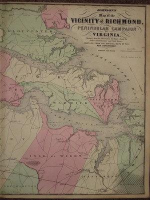
An Original Antique HAND WATER COLORED Map of The 1862 PENINSULAR CAMPAIGN east of RICHMOND from Johnson and Ward's New Family Atlas, published 1863. This CIVIL WAR map shows the counties individually hand water colored along with railroads and hundreds of stage coach and wagon roads from the time period. Exceptionally detailed, the map has arrows showing lines of advance, battles, and the Union lines of retreat. Richmond and Petersburg which would suffer almost total destruction less that 2 years after the publication of this map are shown near the western edge of the map. Beautiful original pastel colors. Map measures 18 by 26 inches. Guaranteed an original antique map, I do not sell reproductions of any kind. 100% satisfaction guaranteed! If you are unhappy with an item for ANY reason you can return it for a full refund. If you have a problem please email me before leaving feedback, I am VERY easy to work with.
ADVERTISEMENT
From ebay.com - 1 month ago