
1863 MASSACHUSETTS CONNECTICUT RI MAP CIVIL WAR ERA Johnson Geography Atlas - $25 - (Pelham, AL)
Back to Search Results
Posted 1 month ago
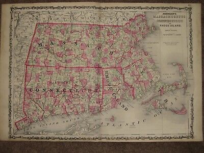
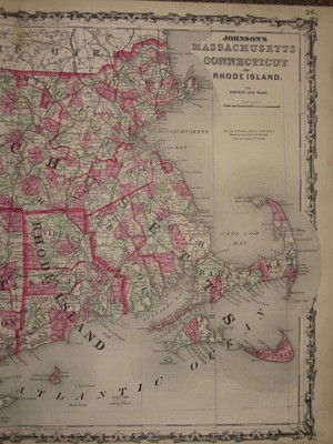
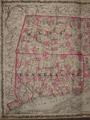
An Original Antique HAND WATER COLORED Map of MASSACHUSETTS, CONNECTICUT, RHODE ISLAND from Johnson and Ward's New Family Atlas, 1863. Exceptionally detailed, even townships are individually hand water colored. Scores of railroads are shown with their names printed next to them. Unusual for this time period even wagon roads and stagecoach routes are shown by the hundreds. Beautiful original pastel colors. Map measures 18 by 26 inches. Guaranteed an original antique map, I do not sell reproductions of any kind. 100% satisfaction guaranteed! If you are unhappy with an item for ANY reason you can return it for a full refund. If you have a problem please email me before leaving feedback, I am VERY easy to work with.
ADVERTISEMENT
From ebay.com - 1 month ago