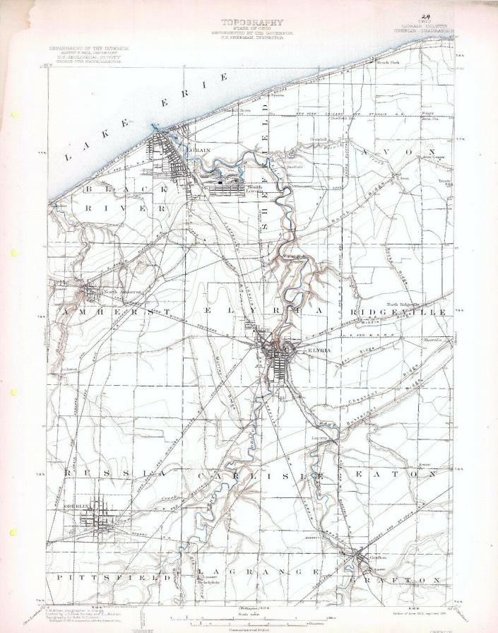
1903 Oberlin OH USGS 15' Quad Topo Map Lorain Elyria Amherst Avon Ridgeville - $18 - (Middlefield, OH)
Very cool 15 minute sheet, 1908 edition, printed in 1921, and surveyed in 1905-06. Includes standard USGS map information printed on back. My dad purchased a binder of the entire state of Ohio perhaps 40 years ago, and I have stored them for some time. Downsizing now. These are about 16 x 20 inches, very suitable for framing. Includes Sheffield, Black River, Amherst, Elyria, Russia, and Carlisle Townships, and portions of Avon, Ridgeville, Eaton, Grafton, Lagrange, and Pittsfield Townships in Lorain County. Also such place names as Beach Park, Folger, Avon Station, Avon, Avon Center, Trinity, Crandall, Sheffield, South Lorain, Oakpoint, North Amherst, North Ridgeville, North Ridge, Middle Ridge, Sugar Ridge, Chestnut Ridge, Butternut Ridge, Rocky Ridge, Laporte, Oberlin, Eaton, and Nickelplate. Electric Interurban Railroad Lines shown include multiple lines of both the Lakeshore Electric RR and the Cleveland Elyria & Western Electric RR. Other Railroad lines include the Lakeshore & Michigan Southern RR; New York Chicago & St Louis RR; Cleveland Lorain & Wheeling RR; Wheeling & Lake Erie RR; Lorain Ashland & Southern RR; and the Cleveland Cincinnati Chicago & St Louis RR. Additionally a large number of quarries are shown with associated railroad spur lines connecting them to the main roads. I will also be listing the option to purchase the entire State of Ohio (200+ maps) on an SD Card in pdf format. Multiple auctions ship at no extra cost; please request an adjusted invoice. Shipped rolled in a USPS Priority Tube.

ADVERTISEMENT
From ebay.com - 1 month ago

