
Antique 1860 New York State Canvas School Map Pre Civil War Map - $329 - (Thompson, PA)
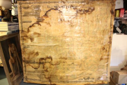
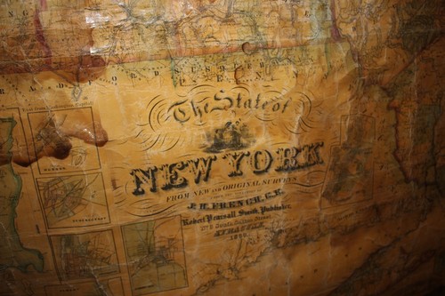
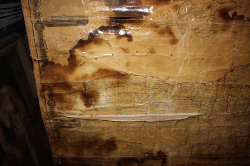
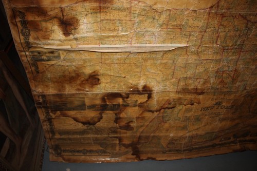
DESCRIPTION For your consideration is this 1860 Map of New York State from Original Surveys under the directory of J. H. French and published by Robert Pearsall Smith in Syracuse NY. Map is 72 by 68 inches. Please, scroll down to see many pictures. CONDITION Map shows heavy water damage and creasing. Some rips, lots of age wear. The canvas is loose from the lower roller, but the lower roller is included. Please, check photos and do not hesitate to contact with any questions. Please, read description and check photos carefully, and don't hesitate to contact with any questions you might have. I am also on Facebook: https://www.facebook.com/DrFrankenstoy/ You can also contact by phone: 607 768 8551 I ship Worldwide. Questions about international shipping? Please ask. Returns accepted within 14 days of receiving item. Customer pays return shipping unless return is due to a mistake in description. Pennsylvania buyers must add a 6% sale tax to the total. I try to ship my items within 24 hours of receiving payment but sometimes it can take me 3-4 business days to ship. I appreciate your patience. inkfrog terapeakinkfrog terapeak

ADVERTISEMENT
From ebay.com - 1 month ago