
1940's Army (like USGS) topographic map Paxton Massachusetts -Sheet 6668 IV SW - $25 - (Slingerlands, NY)
Back to Search Results
Posted 1 month ago
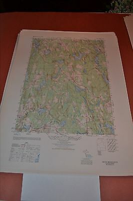
This is an Army Map Service map (AMS V814) of Paxton from the 1940's (printed 1950) showing Leicester north and west to Rutland; This was developed as part of the war effort and was distributed to libraries after the war. This map is suitable for framing and guaranteed original. 22x29 1:25,000 Shipping is for US addresses and I will combine shipping. These maps have been stored flat since printing and will be shipped in a sturdy shipping tube. Look for my other similar maps of the area. If you would like combined shipping, contact me prior to bidding.
ADVERTISEMENT
From ebay.com - 1 month ago