
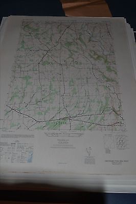
1940's Army (like USGS) topo map Cakepoulin Creek New Jersey 6065 III SW - $30 - (Slingerlands, NY)
This is an Army Map Service map (AMS V822) of Cakepoulin Creek (printed 1946, based on 1942 aerial photography ) showing Franklin, Union and Raritan Townships including Croton, Cherryville, Quakertown, Allens Corner, Pittstown, Hensfoot and Jutland. nbsp; This was developed by the military as part of the effort associated with World War II and was distributed to select libraries after the war. This map is suitable for framing and guaranteed original. 22x29 1:25,000 Shipping is for US addresses and I will combine shipping. These maps have been stored flat since printing and will be shipped in a sturdy shipping tube. Look for my other similar maps of the area. I will combine shipping if you buy multiple maps. This sale is for my only copy of this map.
ADVERTISEMENT
From ebay.com - 1 month ago