
Original 1868 Map NORTHAMPTONSHIRE England Canals Abbeys Daventry Corby Rushden - $20 - (Lake Worth, FL)
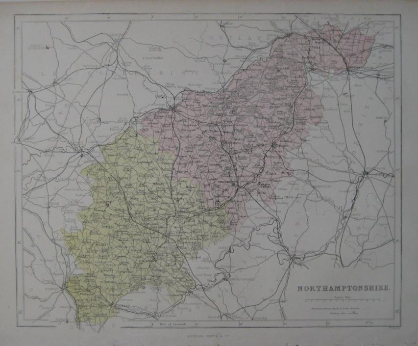
Original antique engraved 1868 map of Northamptonshire, printed more than 150 years ago. The map was engraved by William Hughes and published by Virtue & Company, London in N.E.S.A. Hamilton's National Gazetteer of Great Britain and Ireland. The image area measures 24 x 29.7 cm [9½" x 11½"]. The distance scale is in English miles. Details include roads, railways, canals, cities, towns, abbeys, and natural features in the historic county of Northamptonshire in the East Midlands of England. Among the specific named places and features are the Oxford Canal, Higham Ferrers, Sulby Hall, Kettering, Fineshade Abbey, Oundle, Wellingborough, Rushden, Daventry, Weedon Beck, Thrapston, Salcey Forest, the River Nene, Delapre Abbey, Rothwell, Kings Cliffe, Corby, Rushden, the county town of Northampton, and hundreds more. Condition: This map is in very good condition, bright and clean, with no marks, rips, or tears. It is blank on the back, with no printing on the reverse side. Please see the scans and feel free to ask any questions. It is an original, authentic antique map, not a reproduction or modern reprint, and it is fully guaranteed to be genuine. It would look wonderful matted and framed, and it would make an impressive display in your den or office. It would also make a perfect gift, and we'll include our helpful framing tips for your reference. Buy with confidence! We are always happy to combine shipping on the purchase of multiple items — just make sure to pay for everything at one time, not individually. Powered by SixBit's eCommerce Solution
ADVERTISEMENT
From ebay.com - 1 month ago