
368 Results for Antiques for sale in Columbiana Al - Classifieds
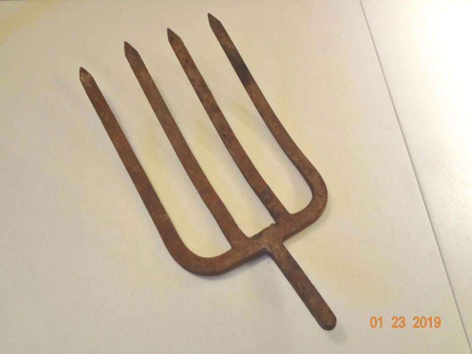
Vintage Antique Metal Hay Pitch Fork Head Farm Tool Rustic Primitive Decor Vintage - aged - lots of rust
1 month ago on ebay.com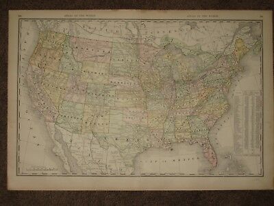
An Original Antique Map of NORTH AMERICA from Rand McNally and Co Atlas, published 1888. States and Territories are individually colored and hundreds of railroads from the time period are shown. McNally rarely dated…
1 month ago on ebay.com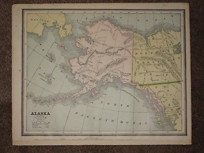
An Original Antique Map of ALASKA from George Cram's FAMILY ATLAS of the WORLD, published 1889. The coastline of ALASKA had been known for nearly a century at the time, but just prior to the ALASKA Gold Rush only a …
1 month ago on ebay.com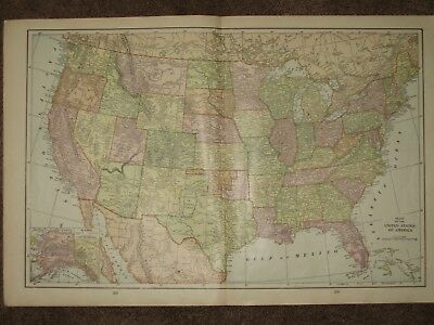
An Original Antique Map of the UNITED STATES from George Cram's UNRIVALED FAMILY ATLAS of the WORLD, published 1901. The map shows States individually colored, along with hundreds of towns and railroads. Cram almost…
1 month ago on ebay.com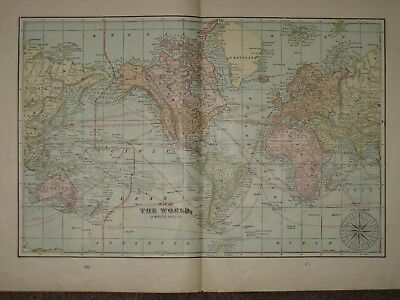
An Original Antique Map of The WORLD from George Cram's UNRIVALED FAMILY ATLAS of the WORLD, published 1901. The map shows the continents individually colored, ocean currents, and major steamship routes and their mi…
1 month ago on ebay.com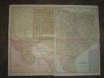
An Original Antique Map of TEXAS from George Cram's UNRIVALED FAMILY ATLAS of the WORLD, published 1901. Two maps, one of WEST TEXAS the other of EAST TEXAS, each of which measures 22 by 15 inches. Also there are 4 …
1 month ago on ebay.com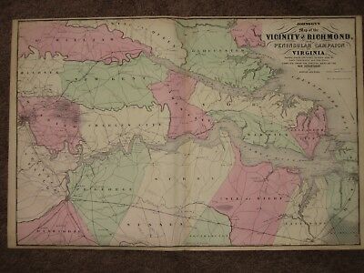
An Original Antique HAND WATER COLORED Map of The 1862 PENINSULAR CAMPAIGN east of RICHMOND from Johnson and Ward's New Family Atlas, published 1863. This CIVIL WAR map shows the counties individually hand water col…
1 month ago on ebay.com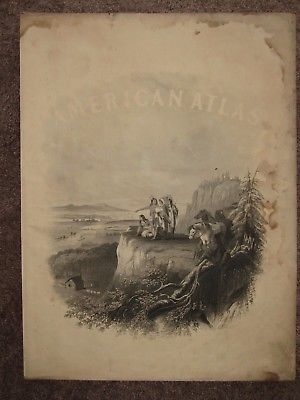
An Original Antique PRINT from Johnson and Ward's New Family Atlas, published 1863. This CIVIL WAR Era print depicts a group of Native Americans in the foreground observing the changes which have occurred to the Ame…
1 month ago on ebay.com