
1691 Results for Antiques for sale in Delanson Ny - Classifieds
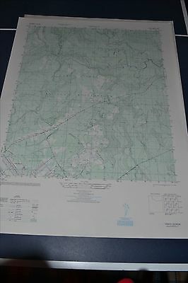
This is an Army Map Service map (AMS V845) of Trinity showing from Camp Stewart itself (including Liberty Field) north and east into Liberty County (printed 1948). nbsp; This was originally developed by the milita…
1 month ago on ebay.com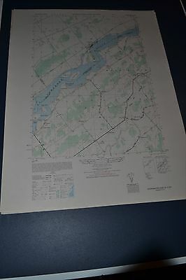
This is an Army Map Service map of Sparrowhawk Point from the 1940's showing the Saint Lawrence River from Round Island to east of Whitehouse Creek Twin Island including the Galop Canal and Iroquois Ont. This was de…
1 month ago on ebay.com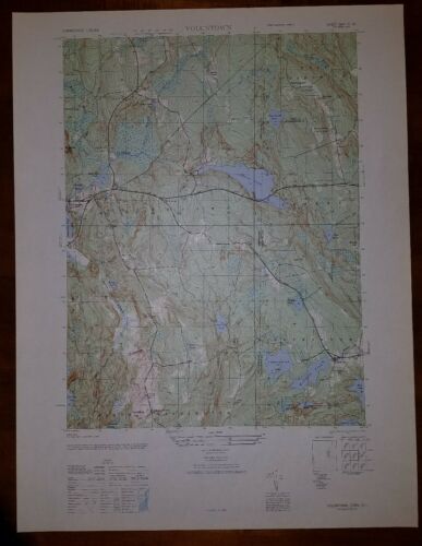
This is an Army Map Service map (AMS V814) of Voluntown from the 1940's (printed 1949) showing parts of New London County and Kent and Washington Counties in RI. This was developed as part of the war effort and was …
1 month ago on ebay.com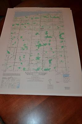
This is an Army Map Service map (AMS V821) showing Barker and Camp Kenan on Lake Ontario in the towns of Somerset and Hartland (printed 1946-50). This was developed as part of the war effort and was distributed to s…
1 month ago on ebay.com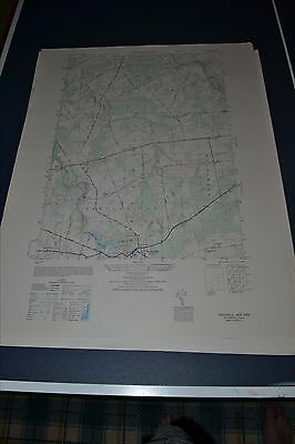
This is an Army Map Service topographic map of Parishville from the 1940's showing north to the St. Regis River showing part of Stockholm and Trout Brook. This was developed as part of the war effort and was dist…
1 month ago on ebay.com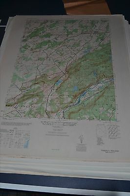
This is an Army Map Service map (AMS V822) of Tranquility (printed 1946, based on 1942 aerial photography ) showing Allamuchy, Frelinghuysen and Green Townships, including Brighton, Long Bridge, and Alphano. nbsp; T…
1 month ago on ebay.com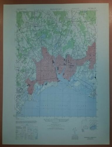
This is an Army Map Service map (AMS V814) of Bridgeport from the 1940's showing north to Easton. This was developed as part of the war effort and was distributed to select libraries after the war. This map is su…
1 month ago on ebay.com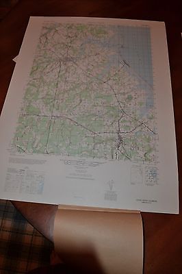
This is an Army Map Service map (AMS V732) of Cedar Creek from the 1940's , showing Milton, Ellendale, Milford, Fowler Beach and Slaughter Beach. This was developed as part of the war effort and was distributed to…
1 month ago on ebay.com